Le Glèbe
Utsjånad
| Le Glèbe | |||
|---|---|---|---|
 | |||
| |||
| Plassering | |||
| Styresmakter | |||
| Land | |||
| Kanton | kantonen Fribourg | ||
| Distrikt | Sarine | ||
| Språk | fransk | ||
| Geografi | |||
| Flatevidd - kommune |
10,31 km² | ||
| Innbyggjarar - kommune (desember 2010) - folketettleik |
1 123 108,9 /km² | ||
| Koordinatar | 46°43′0″N 7°2′0″E / 46.71667°N 7.03333°E | ||
| Diverse annan informasjon | |||
| Postnummer | 1695 | ||
| Nettstad: www.leglebe.ch | |||
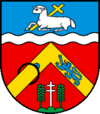
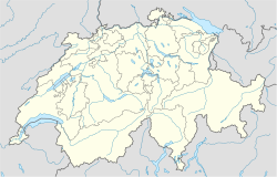
Le Glèbe er ein kommune i distriktet Sarine i kantonen Fribourg i Sveits. Kommunen har 1 123 innbyggjarar (2010) og eit areal på 10,31 km².
Kommunen vart skipa 1. januar 2003 då Estavayer-le-Gibloux, Rueyres-Saint-Laurent, Villarlod og Villarsel-le-Gibloux vart slått saman.[1]
Kjelder
[endre | endre wikiteksten]- Denne artikkelen bygger på «Le Glèbe» frå Wikipedia på engelsk, den 17. mars 2012.
- Wikipedia på engelsk oppgav desse kjeldene:
- ↑ Amtliches Gemeindeverzeichnis der Schweiz published by the Swiss Federal Statistical Office (tysk)
Bakgrunnsstoff
[endre | endre wikiteksten]- Offisiell nettstad (fransk)
- Estavayer-le-Gibloux på tysk, fransk og italiensk i det nettbaserte Historisches Lexikon der Schweiz/Dictionnaire historique de la Suisse/Dizionario storico della Svizzera.
- Rueyres-Saint-Laurent på tysk, fransk og italiensk i det nettbaserte Historisches Lexikon der Schweiz/Dictionnaire historique de la Suisse/Dizionario storico della Svizzera.


